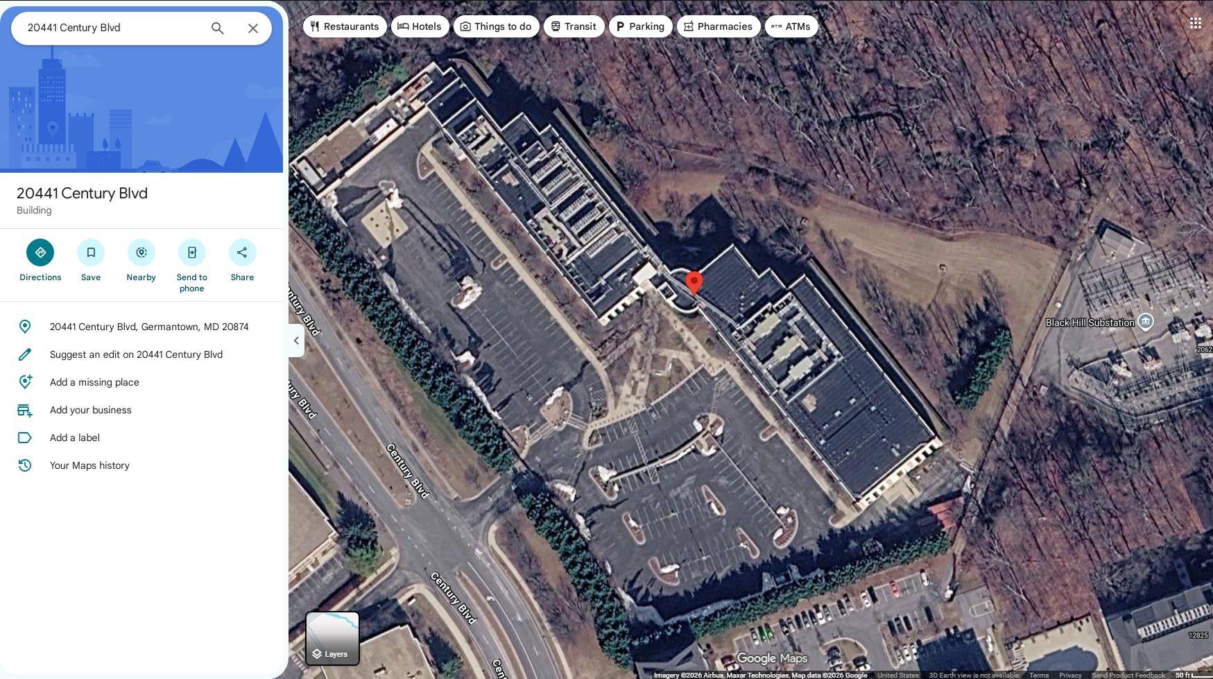
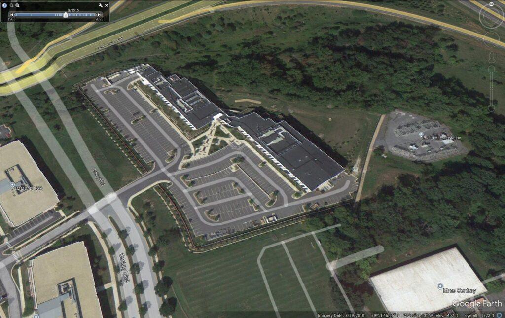
20441 Century Blvd, Germantown, MD 20874
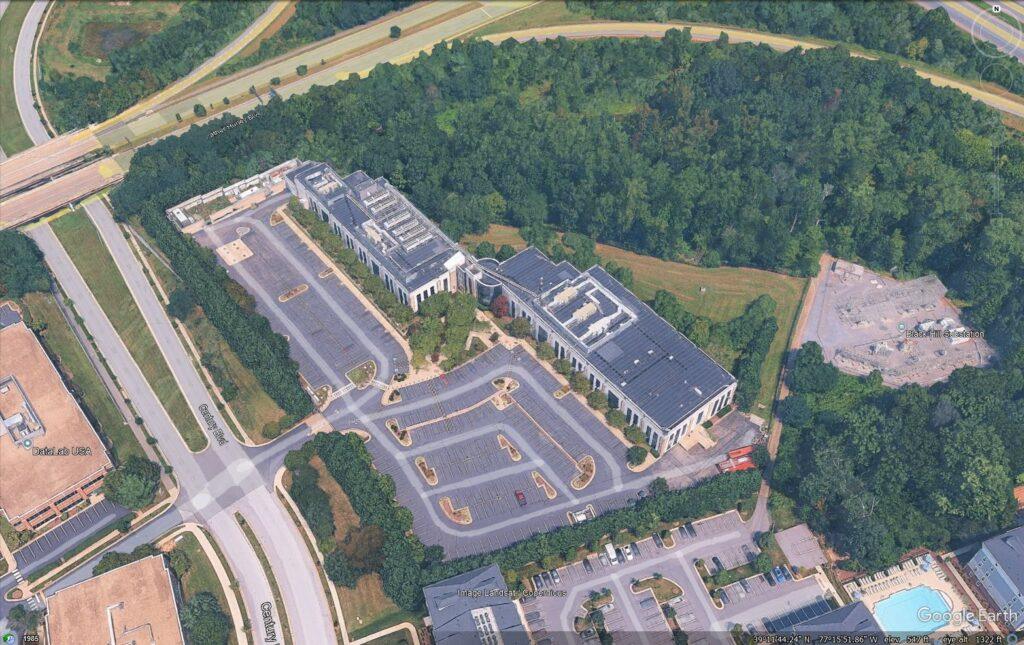
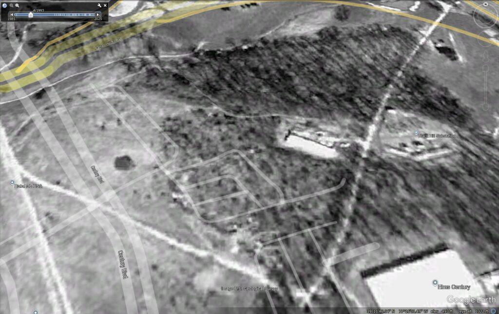
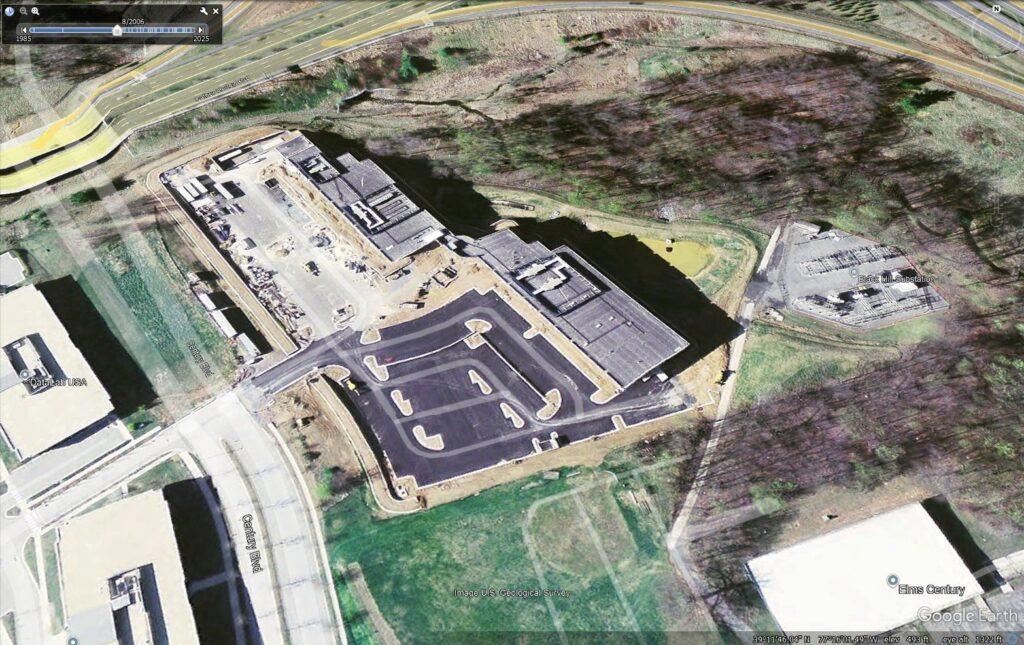
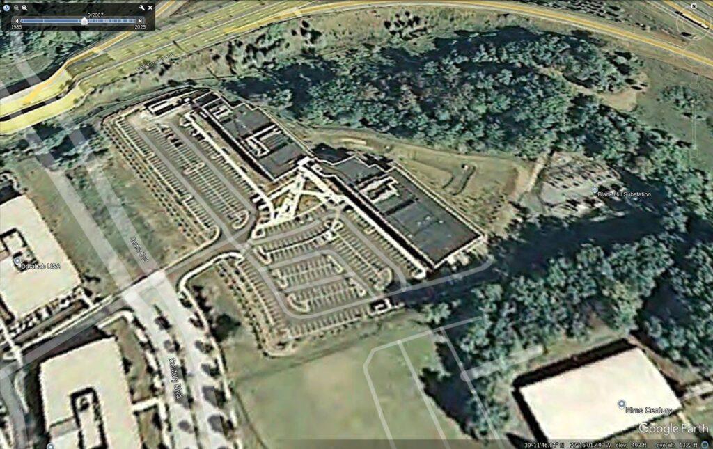
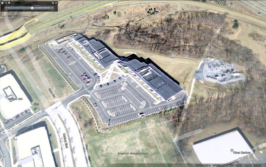
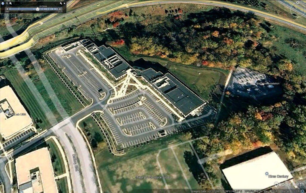
20 years in our midst with mostly commercial neighbors, recently with immediately adjacent residential neighbors to the southeast. Never a single official complaint. A deep delve reveals: No local clouds or weather disruption. No roaring jet engine turbine generators. No earthly rumble or tectonic upsets. No power brownouts or blippages. No water gulp nor spew. A seemingly ‘perfect neighbor’. A few years after its forced divestiture from power generation into distribution, the PEPCO Black Hill substation was built right alongside thie datacenter at the same time, suggesting this may have been an incubator / pilot / test project of some sort. There may be some weirdness about the land ownership. This facility compares as being ‘on the small side’ versus new-fangled, dangerous, massive Hyperscale Datacenters. Size matters.
Electrical Gluttony. Water Consumption. Noise Pollution. Ground Vibration. Powerline Harmonics. Exploring the Web of Land-Grabby, Depopulative, Anti-Meat, Anti-Farm and Anti-Human Incessant Toxic Badness.
Covering every known aspect of Datacenters, including the paranormal.
Sourced Series deeply explores the Many Serious Ill-Effects of Datacenters.
Every statement is sourced by scientific studies, published anecdotes, harmed victims.
Learn from others’ mistakes, or suffer similarly.
“A 2026 power-engineering study found that hyperscale data centers behave not merely as electrical loads, but as vast power-electronics systems whose rapidly fluctuating server demands can excite grid oscillations and propagate disturbances across interconnected networks. Far from a fringe “dirty electricity” claim, the research suggests data centers may interact with the power grid in ways fundamentally different from traditional industrial facilities, raising serious new concerns about resonance, stability, reliability.”
20441 Century Blvd, Germantown, MD 20874.
Bottom line
This is not just a generic office building — public permit records and data-center directories
identify it as the Recovery Point Systems Germantown data center / colocation /
disaster-recovery facility.
The county property record describes the building type as “Computer Center”, with a 2006 year
built, about 114,067 sq ft gross floor area, on 12.57 acres. Building permits show original
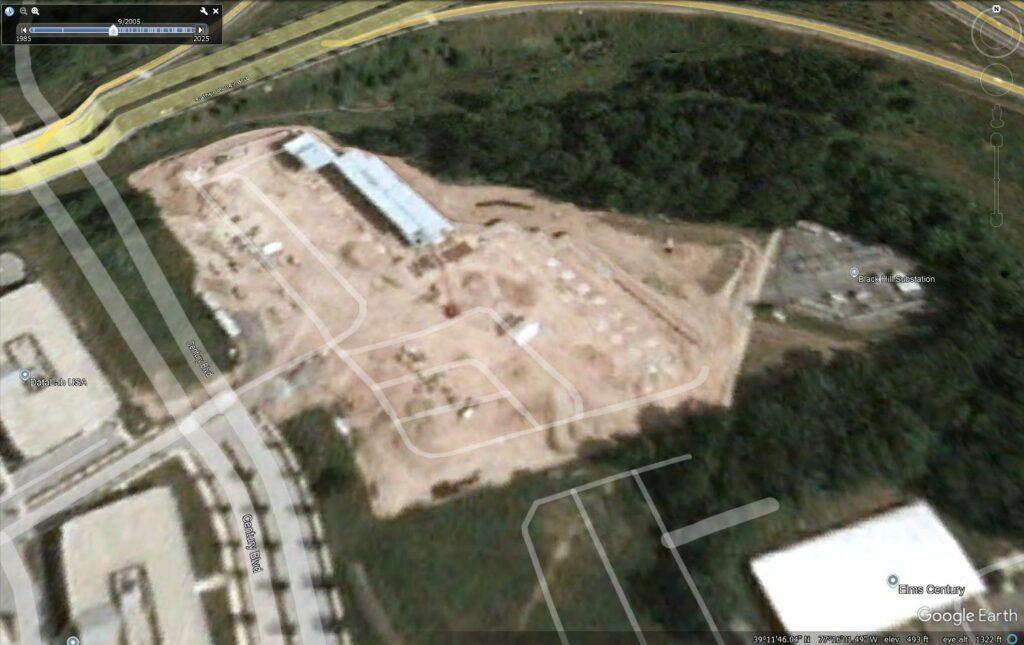
shell/foundation work beginning in the mid‑2000s, then repeated
electrical/mechanical/data-center upgrades: UPS rooms, chillers, CRAC units, generator
pads/yards, Tier III chiller work, and “DATA CENTER FIT OUT.”
────────────────────────────────────────────────────────────────────────────────
Identity / operator
Facility name used publicly:
- Recovery Point Germantown Data Center
- Recovery Point Systems: Germantown
Operator:
- Recovery Point Systems
Sources:
- Data Center Map lists: Recovery Point Germantown Data Center, operator Recovery Point Systems,
address 20441 Century Blvd, Germantown, MD 20874. - Datacenters.com listing identifies Recovery Point Systems: Germantown at 20441 Century
Boulevard. - GoDataCenters lists it as Recovery Point Germantown Data Center, operated by Recovery Point
Systems. - ColoMap lists it at the same address and describes it as a Tier III colocation / disaster
recovery facility.
Source pages:
- https://www.datacentermap.com/usa/maryland/germantown/recovery-point-data-center/
- https://www.datacenters.com/recovery-point-systems-germantown
- https://godatacenters.com/data-centers/maryland/germantown/recovery-point-germantown-data-cent
er-9f18aaeb - https://colomap.com/facilities/recovery-point-germantown-data-center/
────────────────────────────────────────────────────────────────────────────────
Official county property data
From Montgomery County GIS/property layers:
Address: 20441 Century Blvd, Germantown, MD 20874
Account / parcel: 03355006, commonly represented as 02-03355006
Legal description: PAR R CLOVERLEAF CTR
Year built: 2006
Gross floor area: 114,067 sq ft
Site area: 12.57 acres
Land-use category: Office
Assessment zoning/category shown: Industrial
Building type fields: Computer Center
Owner occupancy: No
Transfer date shown: 2017-11-16
Sales price shown: $0
Assessment values shown:
- Land assessment: $1,885,500
- Improvement assessment: $22,259,400
Important ownership note: the county open GIS data I queried exposed the owner mailing address
but not a clean owner-name field in that layer. The mailing address is:
75 W Watkins Mill Rd, Gaithersburg, MD 20878-4021
That address is also publicly associated with Recovery Point Systems in business listings. So
the public record strongly ties the property to Recovery Point, but I would treat the exact
titled ownership entity as “not fully confirmed” without manually checking SDAT / land records.
────────────────────────────────────────────────────────────────────────────────
Construction / permit history
Montgomery County commercial permit records show 44 commercial building permits for this
address.
Key early/original construction permits:
2004–2007 original shell / fit-out
- Permit 338855
- Added: 2004-03-29
- Issued: 2007-07-25
- Finaled: 2007-08-17
- Work type: Build foundation
- Area: 114,067 sq ft
- Declared value: $2,851,675
- Description: Shell
- Use code: Industrial Building
- Permit 368847
- Added: 2004-12-22
- Issued: 2007-07-25
- Finaled: 2007-08-17
- Area: 62,502 sq ft
- Declared value: $2,500,080
- Description: Tenant fit-out / foundation & shell permit 338855
- Mentions U&O 233444 and multiple architectural/electrical/mechanical revisions.
- Permit 375171
- Issued: 2005-03-29
- Finaled: 2008-07-22
- Area: 4,973 sq ft
- Description: Change in exterior stair, generator pad and dock, revision to 338855
So: property record says 2006 built, while permit timeline shows construction/foundation/shell
work spanning 2004–2007, with final approvals in 2007.
────────────────────────────────────────────────────────────────────────────────
Data-center-specific permit evidence
Several permits directly confirm data center use and infrastructure.
Mechanical / electrical / data center buildouts
- 2010 — Substation No. 2
- Permit 525069
- Issued 2010-03-05
- Area 2,858 sq ft
- Declared value $275,000
- Description: Substation No. 2
- 2010 — UPS room
- Electrical permit 523815
- Description includes:
- Project X UPS Room #1121
- 2 × 1200 amp feeders
- 750kVA UPS
- 1200 amp panel
- 2012 — CRAC / computer-room cooling
- Commercial permit 601357
- Issued 2012-07-25
- Description: Electrical & Mechanical work only to install computer room air conditioning
units - Electrical permit 602235
- Description: Project X tape Robot Room Wing #1 2nd Floor — 3 additional CRAC units
- 2014 — Computer hosting data center
- Permit 671861
- Issued 2014-07-15
- Finaled 2017-07-19
- Area 8,252 sq ft
- Declared value $750,000
- Description: COMPUTER HOSTING DATA CENTER #4 — 1st Floor
- 2014 — related electrical
- Electrical permit 672232
- Description includes:
- Project X Computer Hosting Data Center #4
- 1200 amp feeder
- 800 amp feeder to UPS
- 500kW UPS
- 3 × 300kVA PDU
- CRAC/electrical infrastructure
- 2016–2017 — Generator / fuel / Tier III chiller work
- Permit 758697
- Issued 2016-11-16
- Description: Generator Yard Expansion — Phase one Underground Storage Tanks for Fuel
Oils - Declared value $541,380
- Permit 772448
- Issued 2017-07-13
- Description: PROJECT X CLOVER LEAF CENTER — Tier III — B Side Chiller 3
- Permit 758697
- 2019 — Data center piping / generator / fit-out
- Permit 863104
- Issued 2019-03-07
- Description: installing new chiller piping & supports to feed CRAC units in mid-range
data center on the 2nd floor
- Permit 864187
- Issued 2019-05-17
- Declared value $1,000,000
- Description: Generator installation, concrete pads and load-bank cabinets
- Permit 889910
- Issued 2020-06-08
- Area 3,475 sq ft
- Declared value $405,696
- Description: DATA CENTER FIT OUT
- Permit 863104
- 2020 — new data center conversion
- Permit 924637
- Issued 2020-11-18
- Area 1,514 sq ft
- Declared value $296,658
- Description says an existing Second Floor Wing 2 End User Server Room would be
converted/expanded into a new Data Center, with:- new secure demising walls
- raised floor reused and extended
- HVAC and electrical systems removed/replaced
- fire alarm, sprinkler, and FM‑200 suppression updated
- Permit 924637
- 2020 — Tier III electric rooms
- Permit 883541
- Issued 2020-06-08
- Area 490 sq ft
- Declared value $990,000
- Description: ADDING WING TWO TIER‑III ELECTRIC ROOMS A & B
- Permit 883541
- 2021 — chiller / HVAC expansion
- Permit 924966
- Issued 2021-03-19
- Area 3,500 sq ft
- Description: Addition of two new rooftop chiller units and two pumphouse mechanical
penthouse units for future HVAC expansion
- Permit 924966
This is strong evidence of a long-running, heavily engineered data-center facility, not merely
office space.
────────────────────────────────────────────────────────────────────────────────
Facility features claimed by directories
Treat these as directory/operator-marketplace claims, not all independently verified by county
records:
Data Center Map
Claims / describes:
- Tier III-style concurrent maintainability
- carrier-neutral infrastructure
- cloud integration
- access to cloud platforms such as AWS Direct Connect / Azure ExpressRoute
- high-security, high-resilience data center positioning
GoDataCenters
Claims:
- Operator: Recovery Point Systems
- Tier: Tier 3
- PUE: 1.40
- Year built: 2020
- Certifications listed: SOC 2, ISO 27001, HIPAA, PCI-DSS
Note: the “built in 2020” claim conflicts with county property data showing 2006 and permits
from 2004–2007. My read: 2020 likely refers to a particular data-center fit-out/upgrade listing
date, not the original building construction.
ColoMap
Claims:
- Uptime Institute Tier III-certified data center
- 100% uptime SLA
- 2N UPS / 2N generator
- 5–7 days on-site fuel
- approx. 10 kVA/rack base
- disaster-recovery / business-continuity focus
- AWS / Azure cloud on-ramps
- SOC 2 / FISMA / HIPAA stack
County permits do corroborate the kinds of systems implied: UPS, PDUs, substations, CRAC,
chillers, generator yard, fuel tanks, FM‑200, and Tier III-related chiller/electrical work.
────────────────────────────────────────────────────────────────────────────────
Current ownership / previous owners
What I can say confidently
- The facility operator is publicly identified as Recovery Point Systems.
- The county property record mailing address is 75 W Watkins Mill Rd, Gaithersburg, MD 20878,
which is publicly associated with Recovery Point Systems. - The county record shows a transfer date of 2017-11-16 with sales price $0, which often
indicates an internal transfer, entity restructuring, deed correction, merger, or
non-arm’s-length transaction.
What I cannot fully confirm from open data alone
- The exact deeded owner entity name.
- A full chain of previous owners.
- Whether Recovery Point owns the real estate directly or controls it through an affiliate /
holding entity.
I avoided automated scraping of Maryland SDAT because SDAT’s own page displays terms prohibiting
automatic/robotic extraction. A manual SDAT or Maryland Land Records check would likely reveal
the deeded owner name and transfer chain.
────────────────────────────────────────────────────────────────────────────────
Location context
Coordinates from public geocoding / records: roughly 39.192–39.194 N, -77.265 W
The site is in the Cloverleaf / Century Blvd / Germantown technology-office corridor, near:
- I‑270
- Germantown commercial/office campuses
- Montgomery County’s upcounty tech / telecom / life-sciences corridor
- other large office, R&D, and infrastructure-heavy properties
The 12.57-acre site and 114k sq ft building footprint give it room for the kind of exterior
support infrastructure seen in permits: generator yards, fuel tanks, chillers, load-bank
cabinets, rooftop mechanical equipment, and secure service/dock areas.
────────────────────────────────────────────────────────────────────────────────
Confidence levels
High confidence
- It is a data center / computer center.
- It is operated/marketed as Recovery Point Systems’ Germantown facility.
- Original building/property year is around 2006, with major shell/foundation/final permits in
2004–2007. - It has extensive data-center infrastructure: UPS, CRAC, chillers, generators, fuel storage,
FM‑200/fire systems, raised floor, secure demising walls.
Medium confidence
- Tier III status / Tier III design claims. Permits mention Tier III-related chiller/electrical
work, and directories claim Tier III, but I did not independently verify an Uptime Institute
certificate. - Compliance claims like SOC 2 / ISO 27001 / HIPAA / PCI-DSS. Directories claim them; not
independently audited here.
Low / not confirmed
- Exact current deeded ownership entity.
- Full prior ownership chain.
- Whether every published power/capacity/PUE figure is operator-confirmed.
I dug further. Key update: I found stronger corporate/ownership context, but the exact deeded
owner name / deed image chain still requires manual SDAT + MD Land Records access because SDAT
explicitly posts anti-robotic extraction terms and MDLandRec requires account/login for full search.
New findings
1. Recovery Point is now under CBTS
Recovery Point’s own site says:
- CBTS acquired Recovery Point Systems
- Announcement date: Sept. 10, 2026
- Recovery Point brings Tier III, fiber-dense data centers that are “owned, operated, and
expansion-ready.”
Source:
- https://recoverypoint.com/press-release/cbts-acquires-recovery-point-systems-expanding-enterpr
ise-disaster-recovery-cyber-resiliency-and-ai-infrastructure-hosting-capabilities/
So as of that announcement, the business/operator appears to be Recovery Point Systems under
CBTS.
Important wording: CBTS/Recovery Point says the data centers are owned and operated. That
suggests Recovery Point or an affiliate owns the real estate/facility, not just leases it — but
the exact deeded real estate title entity still needs deed confirmation.
────────────────────────────────────────────────────────────────────────────────
2. Recovery Point Systems corporate data
I found official New York open-data corporate records for Recovery Point Systems, Inc.
Recovery Point Systems, Inc.
- NY DOS ID: 5878970
- Entity type: Foreign Business Corporation
- Jurisdiction: Delaware
- Initial NY filing date: 2020-11-16
- Foreign formation date: 2000-02-17
- Process address:
- 75 West Watkins Mill Road
- Gaithersburg, MD 20878
- Registered agent in NY: CT Corporation System
- Recent address/officer data includes:
- Jack Dziak
- Rossabi, Anthon / Tony Rossabi
- 75 West Watkins Mill Road, Gaithersburg, MD
This is important because the Montgomery County property record for 20441 Century Blvd lists
owner/mailing address as:
│ 75 W Watkins Mill Rd, Gaithersburg, MD 20878
That strongly ties the tax parcel’s mailing address to Recovery Point Systems’ corporate
address.
Source:
- NY Open Data active corporations dataset / DOS ID 5878970
- NY filings/address datasets
────────────────────────────────────────────────────────────────────────────────
3. County real property tax record
Montgomery County’s real property tax dataset lists parcel:
- Parcel code: 3355006
- Address: Century BLV
- City: Germantown
- ZIP: 20874
- Residence: Not a principal residence
- Tax class: R042
- 2025 assessment in tax dataset: $17,757,800
- 2025 bill total: $227,506.83
This confirms it is treated as a significant commercial/non-residential taxable parcel.
Note: this differs from the GIS property layer assessment I previously pulled:
- Land: $1,885,500
- Improvements: $22,259,400
- Total: about $24.1M
That discrepancy may be timing/cycle/taxable-assessment related; not unusual across county
datasets.
────────────────────────────────────────────────────────────────────────────────
Current best read on ownership
High confidence
The facility is operated by:
│ Recovery Point Systems, now under CBTS as of the 2026 acquisition announcement.
Medium-high confidence
The real estate is very likely owned/controlled by Recovery Point Systems or a Recovery
Point/CBTS affiliate, because:
- County parcel mailing address matches Recovery Point’s corporate address.
- Recovery Point/CBTS says the data centers are owned and operated.
- Multiple data-center directories identify the site as Recovery Point’s Germantown facility.
- Permits repeatedly reference “Project X,” data center, Tier III, UPS, generator, chiller, and
Recovery Point-type infrastructure.
Still unconfirmed
The exact deeded owner name could be something like:
- Recovery Point Systems, Inc.
- Recovery Point Group Holding Company
- A Delaware/Maryland real estate LLC
- A CBTS/RPS affiliate
- A prior affiliate from the 2017 transfer
I do not want to invent that entity name without the deed/SDAT owner line.
────────────────────────────────────────────────────────────────────────────────
Transfer / deed clue
County GIS shows:
- Transfer date: 2017-11-16
- Sales price: $0
That strongly suggests a non-arm’s-length event:
- internal reorganization
- affiliate transfer
- merger/acquisition-related transfer
- deed correction
- contribution to holding company
- recapitalization / private equity restructuring
This date is earlier than:
- Recovery Point’s 2021 Geminare acquisition
- the 2026 CBTS acquisition
It may line up with Recovery Point’s private-equity / Abry ownership structure, but I did not
find a public deed page confirming that.
────────────────────────────────────────────────────────────────────────────────
Construction date refined
I would now summarize the construction timeline as:
- 2004: initial shell/foundation permit added
- 2005: exterior stair/generator pad/dock changes
- 2006: county property “year built”
- 2007: major shell and tenant fit-out permits issued/finaled
- 2009–2021: major data center upgrades: substations, UPS, CRAC, chillers, generator yard,
underground fuel tanks, Tier III electrical rooms, new data center fit-outs
So: built circa 2006, with operational/final buildout in 2007, and major data-center
expansions/upgrades continuing through at least 2021.
────────────────────────────────────────────────────────────────────────────────
What remains for exact deeded ownership
To get the exact current/previous owners, the necessary manual path is:
- Open Maryland SDAT Real Property Search manually.
- Search:
- County: Montgomery
- Account/Parcel: 02-03355006
- Record:
- Owner name
- Deed reference / liber-folio
- Transfer history
- Then open Maryland Land Records:
- County: Montgomery
- Search by grantor/grantee or liber/folio from SDAT
- Pull the 2017-11-16 deed
- Walk backward through prior deed references
I reached the public/open-data limit without violating SDAT’s anti-automation terms. The next
step needs a human browser session/login through SDAT/MDLandRec.
Concise conclusion
20441 Century Blvd is Recovery Point Systems’ Germantown data center, now part of CBTS. It is a
~114k sq ft computer/data center on 12.57 acres, built circa 2006/2007, heavily upgraded for
Tier III-style resiliency with UPS, generators, chillers, CRAC, fuel storage, FM‑200, raised
floor, and secure data-center buildouts. The property mailing address matches Recovery Point’s
corporate address at 75 W Watkins Mill Rd. Exact deeded ownership still needs manual
SDAT/land-record confirmation.
I went deep through the public/indexed stuff I can reach without violating terms or requiring
logins.
Bottom line
I found no public, indexed government complaint record clearly tied to 20441 Century Blvd /
Recovery Point Germantown Data Center for:
- noise / fan noise / HVAC noise
- generator noise
- rumble / shudder / ground vibration
- pollution / air emissions
- light trespass
- power-line hum / electrical emissions
- microwave/RF emissions
- water use / water pollution / stormwater pollution
That is not the same as proving none exist. It means: in the open datasets and indexed public
web records I checked, I did not find a complaint record attributable to that facility.
Strongest government-data finding
Montgomery County agency/request datasets with actual address fields showed only two
exact-address records for:
20441 CENTURY BLVD, Germantown, MD 20874
Both were:
- Request type: FM05
- Description: DROP BY
- One dated 2020-10-05, location listed as FIRST FERDERAL CORPORATION
- One dated 2025-10-31, location listed as Recovery Point Data Ctr.
Nothing in those visible records indicated noise, pollution, vibration, light, hum, water,
generator, fan, HVAC, or emissions complaints.
Montgomery County MC311 / noise records
I searched public Montgomery County data sources including:
- Noise Complaints dataset
- MC311 Service Requests
- Open MC311 Service Requests
- agency/code-enforcement style service request datasets
The exact-address-capable datasets did not show nuisance/environmental complaints for 20441
Century Blvd.
The broader MC311 dataset has many records for ZIP 20874, including noise, outdoor air,
stormwater, streetlight, dumping, utility/water, and code-enforcement items, but the public rows
visible in that dataset do not reliably expose street address, so I could not tie those general
Germantown/20874 records to 20441 Century Blvd unless the text itself mentioned Century/Recovery
Point/data center. I did not find such a tie.
A targeted ZIP/key-word pass for 20874 with terms like noise, pollution, vibration, light,
generator, fan, emission, hum, and water surfaced records at other addresses — e.g. Kelley Farm
Dr, Mateny Rd, Bromfield Rd, Clopper Rd, etc. — not the data center.
Maryland environmental data
I checked Maryland open-data style MDE datasets for:
- Air/Radiation Administration permits
- Air/Radiation enforcement
- Water and Science Administration enforcement
- Solid waste / Land Management compliance/complaints
Targeted searches for:
- 20441
- Century
- Recovery Point
- data-center-ish Montgomery County names
returned no matching MDE air/water/solid-waste enforcement or permit records in the accessible
datasets I queried.
Important caveat: absence from these public datasets does not prove MDE never received a
complaint; some complaint systems may not publish street-level details or may require MPIA
request.
Web-indexed complaint/search results
Searches for combinations like:
- “20441 Century Blvd” complaint
- “20441 Century Blvd” noise
- “20441 Century Blvd” pollution
- “20441 Century Blvd” vibration
- “20441 Century Blvd” generator
- “Recovery Point” Germantown noise complaint
- “Recovery Point Systems” “20441 Century Blvd” complaint
- “20441 Century Blvd” MDE
- “20441 Century Blvd” EPA
- “20441 Century Blvd” microwave
- “20441 Century Blvd” FCC
did not surface complaint/enforcement pages. Results were mostly data-center directory listings,
maps, or business/contact pages.
Nearby/community context
I also checked for obvious public neighborhood/HOA-indexed complaints, including
Cloverleaf-related searches. I did not find indexed posts or public pages mentioning Recovery
Point, Century Blvd, data-center noise, generators, vibration, or similar nuisances.
What would be needed to prove this harder
To move from “I found no public record” to “government says whether complaints exist,” the next
useful step would be formal/public-record requests:
- Montgomery County DEP / Environmental Protection
- Ask for complaints, inspections, violations, or enforcement records for 20441 Century Blvd
/ Recovery Point Systems / Recovery Point Data Center involving noise, outdoor air, odor,
generators, HVAC/chillers, stormwater, light, vibration.
- Ask for complaints, inspections, violations, or enforcement records for 20441 Century Blvd
- Montgomery County DPS / Code Enforcement / Fire Marshal
- Ask what FM05 DROP BY means and request the records/notes for service request numbers:
- 200079273
- 200136926
- Ask what FM05 DROP BY means and request the records/notes for service request numbers:
- Maryland Department of the Environment
- Ask for complaints/enforcement/permit files for 20441 Century Blvd, including emergency
generators, fuel tanks, air emissions, water/stormwater, hazardous materials, or nuisance
complaints.
- Ask for complaints/enforcement/permit files for 20441 Century Blvd, including emergency
- EPA ECHO / FOIA if needed
- I did not find indexed EPA/ECHO references, but a formal query could confirm whether any
federal facility/environmental records exist under a different entity/site name.
- I did not find indexed EPA/ECHO references, but a formal query could confirm whether any
My best current read: the facility has lots of permitted data-center infrastructure, including
generators/chillers/fuel tanks, but I found no public complaint trail about impacts from that
infrastructure.
Yes — based on what we found, 20441 Century Blvd / Recovery Point Germantown looks
small-to-midsize by modern data-center standards, and very small compared with the new
hyperscale campuses in Loudoun County, VA or Frederick County, MD.
Quick comparison
Building size
Recovery Point Germantown is about 114,067 sq ft gross. New Loudoun and Frederick hyperscale
sites are often 200,000–500,000+ sq ft per building, with full campuses reaching millions of
square feet.
Site size
Recovery Point Germantown sits on about 12.57 acres. New hyperscale campuses often occupy
50–300+ acres, and Frederick’s Quantum Loophole campus is measured in thousands of acres.
Power scale
Recovery Point Germantown appears likely to be in the low single-digit megawatt range to perhaps
low tens of megawatts, though that is not confirmed. New hyperscale campuses commonly require
50–300+ MW per campus, with some planned campuses approaching gigawatt scale.
Generators
Recovery Point Germantown has a backup generator yard and fuel tanks, but likely a limited
generator count. New hyperscale campuses may have dozens to hundreds of large diesel generators
spread across multiple buildings.
Cooling
Recovery Point Germantown uses CRAC units, chillers, and Tier III electrical/mechanical rooms.
New hyperscale sites often have massive chiller/cooling yards, large rooftop mechanical systems,
or advanced air/liquid cooling at campus scale.
Use type
Recovery Point Germantown is primarily a disaster recovery, colocation, and enterprise
resiliency facility. New Loudoun and Frederick sites are more often built for hyperscale cloud,
AI, and data-factory infrastructure.
Community impact profile
Recovery Point Germantown’s impact profile is more likely localized industrial/commercial
impact. New hyperscale campuses can create regional grid, water, land-use, transmission, noise,
and generator-emissions issues.
Why it seems smaller
The Recovery Point facility appears to be an older enterprise colocation/disaster-recovery data
center, not a modern hyperscale cloud/AI campus.
Key signs:
- 114k sq ft is substantial, but not huge anymore.
- The parcel is only ~12.6 acres, limiting expansion, generator yards, substations, cooling
fields, and setbacks. - Permits mention specific internal UPS rooms like 500 kW and 750 kVA, plus CRAC/chiller
additions. That sounds like incremental buildout, not a hyperscale power block. - It was built around 2006–2007, before the current Loudoun/Frederick mega-campus era.
- The facility’s business model appears to be resiliency, disaster recovery, colocation, and
enterprise hosting, not AWS/Microsoft/Google-scale cloud availability zones or AI training
infrastructure.
Loudoun County comparison
Loudoun/Ashburn is basically the world capital of hyperscale data centers. Newer facilities
there often involve:
- multiple buildings per campus
- dedicated substations
- very high-voltage feeds
- tens or hundreds of MW per operator/campus
- huge generator yards
- large rooftop/mechanical yards
- major land-use controversy around transmission lines, noise, and diesel backup emissions
Against that, Recovery Point Germantown is more like a single legacy enterprise data center.
Frederick County comparison
Frederick is increasingly positioned as the next large data-center frontier, especially with
projects like the Quantum Loophole campus near Adamstown.
That type of development is on a completely different order:
- thousands of acres
- planned multi-building campuses
- enormous transmission/power needs
- potentially gigawatt-scale long-term capacity
- regional-scale infrastructure buildout
Compared with that, 20441 Century Blvd is tiny: one 12.6-acre commercial parcel with a ~114k sq
ft building.
My rough read
I’d classify 20441 Century Blvd as:
│ A legacy Tier III-ish enterprise/colocation/disaster-recovery facility, likely modest by
│ today’s hyperscale standards.
Not tiny in ordinary commercial-building terms, but small compared with current hyperscale and
AI-era data centers.
Impact implication
That size difference matters. A facility like Recovery Point can still have:
- generator testing noise
- chiller/HVAC noise
- localized electrical infrastructure
- diesel fuel tanks
- high energy use relative to normal offices
…but it is probably not in the same impact class as the new Loudoun/Frederick mega-campuses that drive regional grid upgrades, large-scale transmission fights, and major cumulative generator-emissions concerns.
The facility immediately near the north Black Hill / Century Blvd area appears to be a small local electric distribution substation, but I still cannot
verify from public records that it is officially named “Black Hill Pepco Substation.”
Important correction: Montgomery County’s public building-address GIS near that spot shows 207xx Century Blvd addresses, not 24401 Century Blvd. Around
the relevant site I found county address points such as:
- 20710 Century Blvd
- 20750 Century Blvd
- 20765 Century Blvd
- 20771 Century Blvd
- 20835 Crystal Rock Dr
- 21200 Dorsey Mill Rd
So “24401 Century Blvd” may be a typo, a future/proposed address, private/internal address, or a mapping-source mismatch.
The small substation polygon just north/northwest of the Black Hill/Century Blvd development area is present in public OSM data as:
- power=substation
- substation=yes
- no public OSM operator/name/voltage tag
That means it is publicly mapped as a substation, but the public map layer I checked does not identify it as Pepco, Potomac Edison, or “Black Hill.”
Most likely function
Given its scale and location, this is almost certainly a distribution substation, not a major transmission switching yard.
Its likely role:
- Serve the Black Hill / Milestone / north Germantown growth area
- Step higher-voltage utility feed down to medium-voltage distribution
- Feed local circuits serving apartments, townhomes, retail, office, roads, lighting, telecom, and nearby public/private facilities
- Provide switching/protection so faults can be isolated and load can be rerouted
It is not a generating station. It does not create power; it transforms and routes grid power.
Technical features likely present
Based on the type and scale of the facility, expected features are:
- Fenced outdoor yard
- One or more power transformers
- Medium-voltage feeder exits
- Buswork and disconnect switches
- Reclosers/breakers
- Surge arresters
- Ground grid
- Control/relay cabinet or small control enclosure
- Remote monitoring/SCADA
- Transformer oil containment/spill controls
- Possibly underground duct-bank exits if feeding newer development
Because no public voltage/operator tag is attached to this exact substation polygon, I cannot responsibly claim exact voltage or transformer MVA.
Capacity
No public capacity rating found.
For a small suburban distribution station, capacity is usually governed by transformer MVA ratings and feeder limits. That data is normally not public.
A plausible suburban station could be in the tens of MVA, but that is an engineering inference, not a verified site fact.
What feeds it?
The immediate Black Hill/Century Blvd substation does not show obvious public OSM high-voltage line connections nearby, which suggests one of these:
- It is fed by underground distribution/subtransmission circuits, or
- The incoming lines are not mapped in OSM, or
- It is a compact/local facility tied into nearby utility distribution rather than a major visible transmission node.
Nearby broader grid context:
- Germantown/Clarksburg has 230 kV transmission infrastructure in the region.
- Pepco and Potomac Edison/FirstEnergy both have infrastructure nearby.
- OSM identifies a Germantown Substation east/southeast of this area as Potomac Edison, not Pepco.
- OSM identifies Pepco substations farther south/east, including Middlebrook/Montgomery Village area assets.
So the exact owner/operator of the Century/Black Hill facility remains unresolved from public sources.
Legal / land-use aspects
Likely legal framework:
- Operated as a public utility facility.
- Subject to Maryland Public Service Commission utility oversight generally.
- Distribution substations usually do not trigger the same CPCN process as new major generating stations or high-voltage transmission lines unless a
qualifying transmission component is included. - Local approvals likely involve:
- Montgomery County site/development review context
- stormwater management
- sediment/erosion control
- forest conservation/tree clearing if applicable
- utility easements
- access rights
- fencing/safety requirements
- noise and screening considerations
The surrounding Black Hill development has Montgomery Planning records, including Black Hill – Townes, application F20240570, approved with conditions
in 2025. That is not proof the substation was part of that approval, but it confirms active/current development review in the immediate area.
Complaints / controversy
I did not find public complaints specifically tied to this Century Blvd / Black Hill substation.
Generic issues that sometimes arise around substations:
- transformer hum
- visual impact
- EMF concerns
- tree clearing
- construction traffic
- stormwater runoff
- perceived property-value concerns
- reliability/outage complaints
But I found no clear public docket/news/planning controversy for this specific facility.
Anything special about design?
Public data suggests ordinary compact distribution-substation design, not a special/high-profile facility.
No evidence found of:
- gas-insulated substation
- architectural disguise
- high-voltage 230 kV switching yard
- dedicated data-center substation
- renewable collector station
- historic structure
- public art/screening program
- black-start or generation role
Current best answer
The facility adjacent to the Black Hill / Century Blvd area is best described as:
│ A small local electric distribution substation serving north Germantown/Black Hill-area load growth. It likely steps utility feed voltage down to local distribution feeders and provides circuit protection/switching for nearby residential/commercial development. Public data does not verify the name “Black Hill Pepco Substation,” does not publish its capacity, and does not identify the exact operator for the specific small substation polygon.